NEWS
Tameside: a barometer of the North / South divide?
from an artist living in Tameside...
++++++++++++++++++++++++++++++++++++++++++++++++++++++++++++++++++++++++++++++++++++++++++++++++++++++++++++++++++++
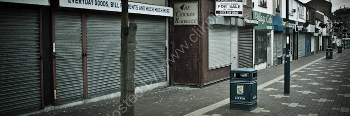
Saw a BBC programme this week that discussed the ongoing boom in London and the contrast between that and the rest of the UK. With that in mind, I thought I should post this photograph from here in Tameside: Stalybridge, to be specific. This is what was once its main shopping street.
For those who do not know the place, Tameside is the eastern bit of Greater Manchester. It’s where much of the industry that Manchester is so famous for developed. The area - a cluster of towns comprising Ashton-under-Lyne, Dukinfield, Stalybridge, Mossley, Denton, Droyslden, Hyde, Audenshaw and Longdendale - is named after the River Tame, which winds through the borough, before meeting the Goyt a few miles further south, in Stockport, to form the Mersey. The towns - yanked together to form Tameside from bits of Lancashire and Cheshire during the 1974 boundary changes - effectively fill the gap between inner-city Manchester and the Pennines, where steep windy slopes mean that building thins significantly before petering out all together, only resuming on the downward side, in Yorkshire.
The area’s fortunes peaked with the UK’s cotton industry, and the Tame Valley still has numerous Victorian cotton mills, though many are now defunct and used as multiple small-scale industrial units, or stand empty, awaiting demolition. There’s a certain defiance and resilience about the place and its people, but as this image indicates, that often feels like something of a rearguard action.
Stephen Riley: Artist, Tameside, Manchester. March 2014